Type log thicker than the interval you are steering through?
Type logs (TL’s) are our models, right? What do we do when the TL model doesn’t reflect the apparent thicknesses in our real-time interpretations? We usually start by dialing in dip solutions well above or below expected dip or introduce small offsets to compensate for more or less section as compared to the TL. If possible, we look for additional TL’s to support our interpretation or we start editing our TL, which is a whole other topic.
So here is a simple approach to an interpretation where the interval thickness is obviously thinning compared to the TL. We see hints of the thinning (vs. the TL) close to landing and at each successive pass up or down section. With each traverse the interpreted dip is dialed up/down to stretch or squeeze the section to match the TL thickness.
In this example (Figure 1), all is good for the first part of the lateral. With small traverses and small dip adjustments, thinning appears minor. The latter portion of the lateral brings large traverses, large dip adjustments and the thinning interval becomes very apparent. The GR correlation to the TL is still spot on, but the resulting structure makes it difficult to project a forward target for the drillers.
How to handle it.
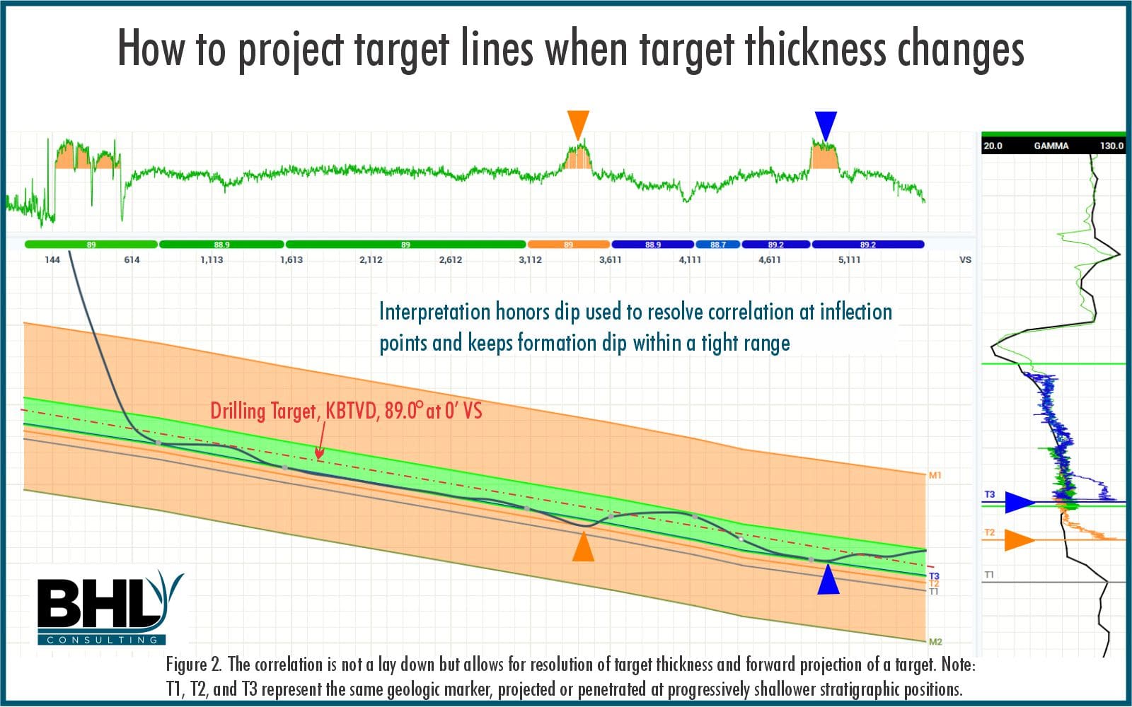
Create an “Alternate” interpretation (Figure 2) incorporating the hints of thinning section, use larger cells (lump vs. split), keep the interpreted dip in a tight range without forcing the correlation to fit to the type log thicknesses. Note that keeping the formation dip close to 89° the bed boundary noted as T1 is encountered 5’ TST higher/thinner at 3450’ VS (T2) and an additional 5’ TST higher/thinner at 4950’ VS (T3). The alternate interpretation suggests that the overall interval has thinned 10’ TST relative to the TL. The GR correlation may take some explaining, but the resulting drilling target line should keep you in zone and out of the ditch.

No way around it, geosteering is a geologic interpretation. Pattern matching can get us just so far before complex stratigraphy, structure or both must be reckoned with. This data set is a simple illustration of thinning section, throw in some structure or positional uncertainty and it could have gotten ugly.
A huge “Thank You!” to our client for permission to use this data! If this is helpful please let us know, we have literally thousands of examples to pull from (with client permission, of course).


0 Comments